Management of Protected Areas to Support Sustainable Economies (MPASSE)

Colliers Wilderness Reserve

In 2010, a grant from the European Commission of just under £2 million was awarded to the consortium, coordinated by UKOTCF. The main part of the grant provided support to each of the National Trust for the Cayman Islandsthe National Parks Trust for the Virgin Islands, and the Turks & Caicos National Trust, for the work outlined below, and a consultancy firm to base a consultant full-time in TCI (where the administrative lead for the project lay) to advise on and monitor the UKOTs’ implementation of the Commission’s financial procedures.

Stunning views over the British Virgin Islands (inset) Project partners; Copyright: NPTVI

A much smaller amount was supplied to UKOTCF to be responsible for the coordination of cross-territory activities of a technical nature, give advice in this area, and monitor and report on progress from a scientific/ conservation aspect. The Trusts and UKOTCF had to make considerable contributions to the project from other resources.

The project was designed to run for 3 years, followed by a couple of years to tidy up all reporting and accounting before the close of spend on the 9th European Development Fund (EDF9) on 31 December 2012. Because of the delays at the European Commission in reaching contract stage, this 3+2 year plan had to be completed in 2 years. This put unnecessary pressure on the 3 UKOT partners, especially in view of the Commission’s inflexible tendering and purchasing requirements (which do not vary with the size of a project, so that the ones required of this small project are the same as for a major construction project).

Background

Like many other UKOTs, the British Virgin Islands (BVI), the Cayman Islands (CI) and the Turks & Caicos Islands (TCI) are particularly rich in biodiversity (of much greater global importance than that of Britain and Northern Ireland, despite their small extents).

This biodiversity has served to underpin sustainable livelihoods in these areas for many generations. Biodiversity also provides the potential to underpin continued and raised living standards in such areas, especially through sustainable tourism. These natural assets needed both safeguarding and management, in order to provide the features which provide the attractions on which sustainable tourism can be based, and which also maintain the quality of life and culture of local communities.

The natural areas on which such sustainable development depends are under threat from non-sustainable developments, which tend to benefit short-term interests and foreign corporations, rather than the long-term interests of local communities and the environment. The development and implementation of reasoned management plans, which also address adequately the potential sustainable economic benefits these areas may offer are therefore critical. The development of such plans in small island economies, like the UKOTs, is demanding in resources and expertise – and implementation even more so.

The Governments of the UK Caribbean Overseas Territories, indicating their commitments to conserve threatened globally important biodiversity and support those communities who wish to continue sustainable livelihoods based on traditional uses of biodiversity, have signed various international environmental agreements. The Governments are committed to the implementation of environmental programmes geared towards supporting effective biodiversity conservation and making tourism more environmentally sustainable. As such, environmental aspects are integrated into good governance of the territories via their Environment Charters signed with the United Kingdom in 2001. The Environment Charters are in keeping with the White Paper Partnership for Progress and Prosperity in which the UK Government outlined its expectations for good governance in the UK Overseas Territories,  by encouraging these measures, which are needed for the preservation of the environment, the promotion of high standards of financial accountability, respect for human rights and compliance with the rule of law.

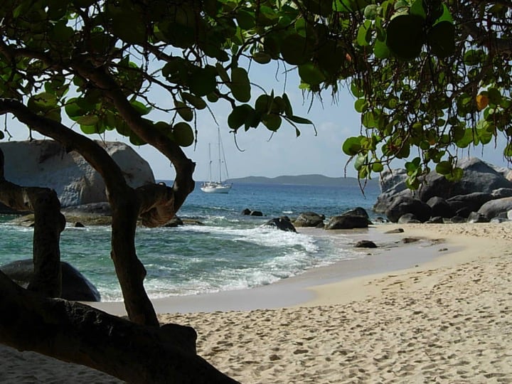
Project activities were aimed at two problems, which were addressed by an integrated approach. One consists of the threats to critically endangered ecosystems and the other is the lack of alternative types of economic development to high-impact ones (including tourism).

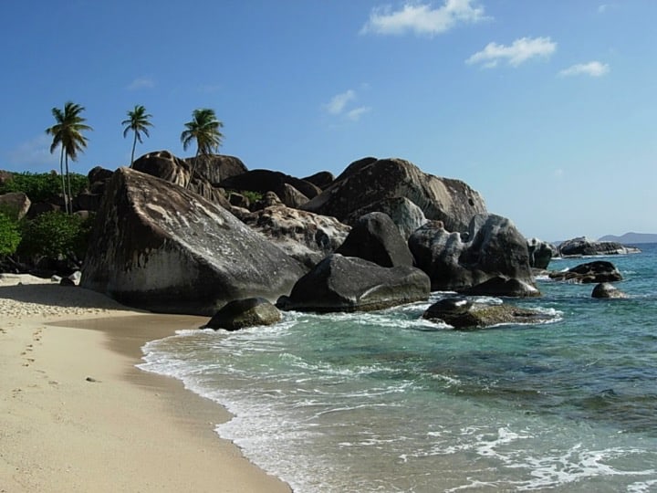
This project aimed to forge a dual path to biodiversity protection through management of protected areas and stimulation of land-based eco-tourism which was currently under-developed.

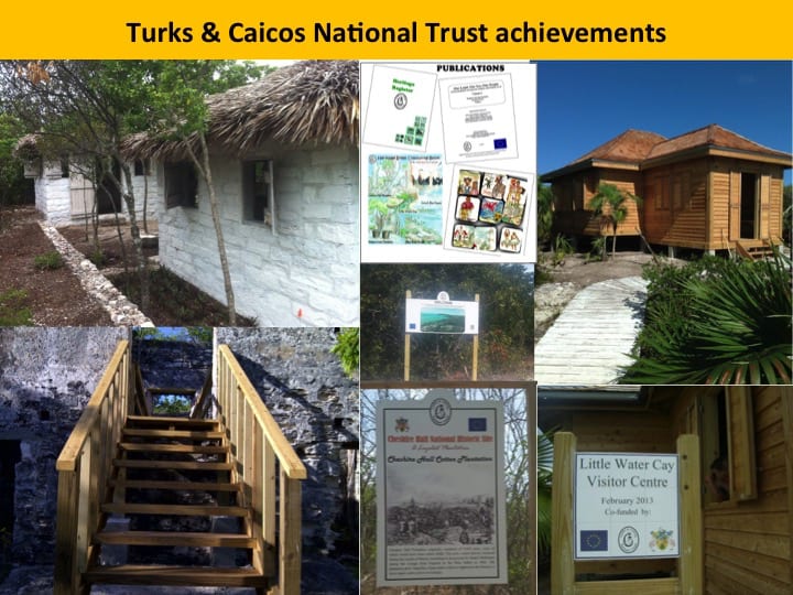
Each territory was able to build on these, enhanced by the sharing of expertise and training between the environmental trusts located in the three territories. These linkages were fostered by UKOTCF.

Project purpose and activities

 The grant was made in support of the implementation of activities geared at achieving the overall project objective of fulfilling environmental agreements and, in so doing, support sustainable development in BVI, CI and TCI. The purpose of the project was to implement integrated management plans for conservation management and sustainable use of protected areas and their surroundings.

 Activities included:

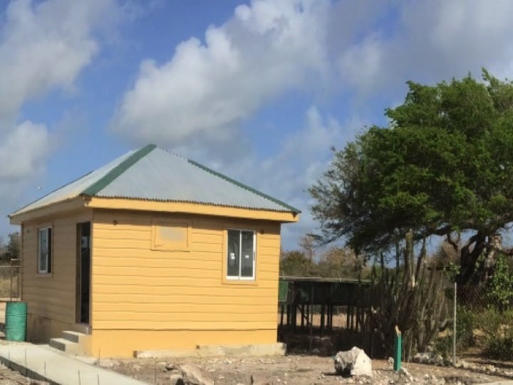
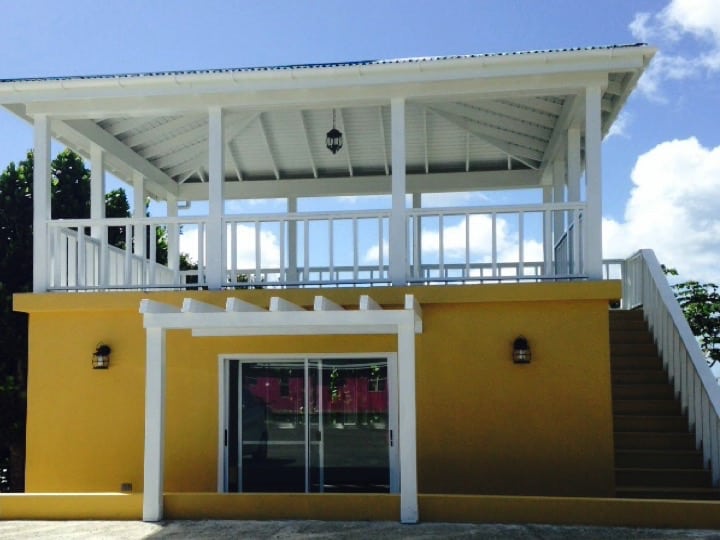
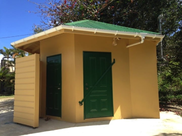
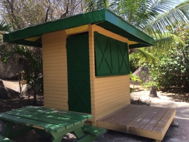
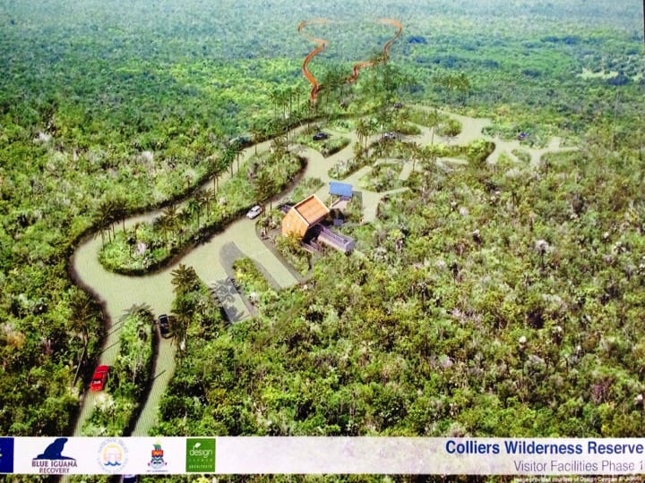
  • Putting in place facilities for conducting ecologically sustainable visitor tours with trained staff to generate self-sustaining income. Sharing expertise and experience between the three participating countries developed this.
  • Providing and implementing the use of environmental educational and public awareness material. This involved consultations with local people. Materials were designed to help influence decision-makers including developers and planning authorities.
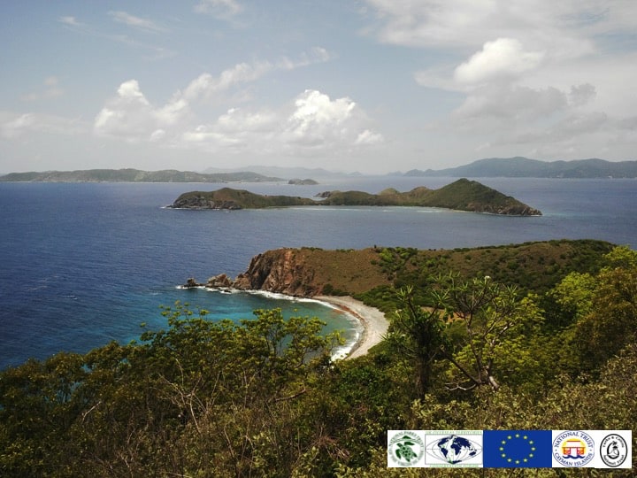
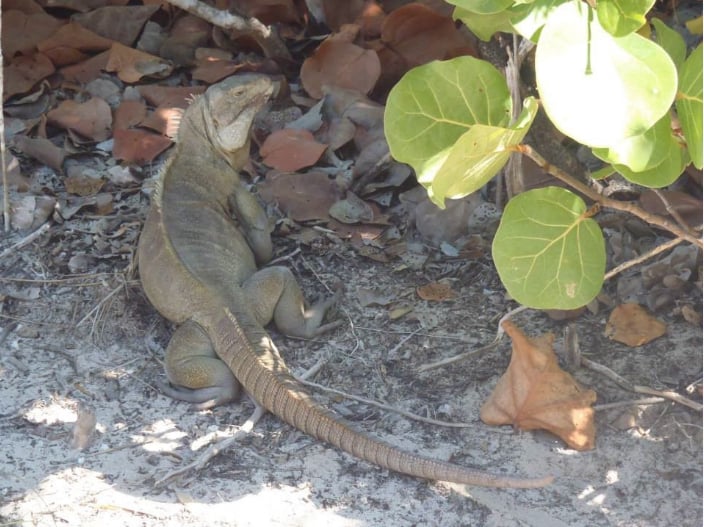
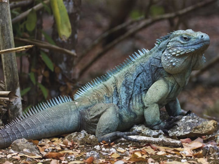
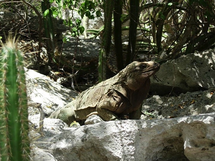
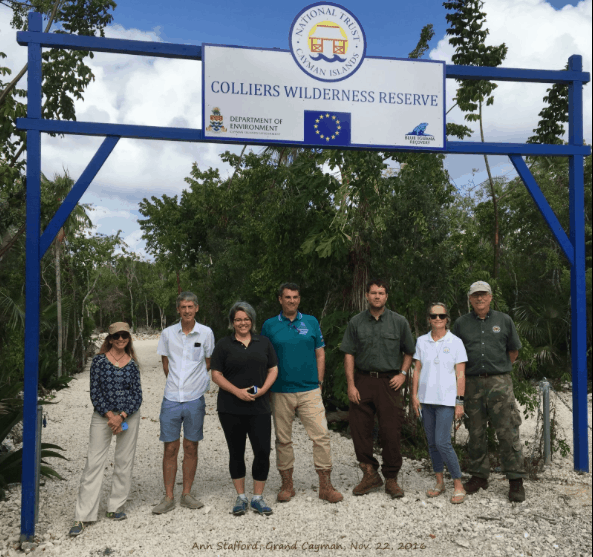
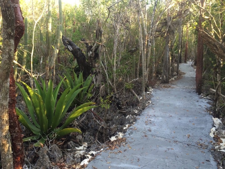
  • Implementing conservation measures to provide increased protection for key vulnerable ecosystems; centring on globally threatened tropical dry forest, combined with the particular features of the country. This was linked with visitor facilities and educational and public awareness material.
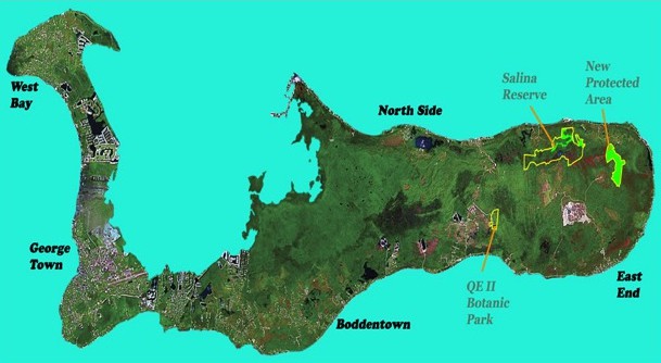
  • Development of management plans for key protected and vulnerable areas; to address species recovery issues, maintenance of biodiversity, control of human-introduced exotic invasive species, habitat restoration and management of visitors and conduct supporting research.
  • Sharing of expertise and training between the three territories, to enable efficient and cost-effective implementation of desired outcomes in each territory.

British Virgin Islands

Copper Mine Point

The Copper Mine Point National Park, located on Virgin Gorda’s southwest tip, was mined by Cornish miners between 1838 and 1867, and perhaps even earlier by the Spanish. Today the remains of the chimney, boiler house, cistern and mine shafts can be seen.

A visitor centre was installed at the site through the project, providing a refreshment area/small café and a small office, with interpretive materials and collection of entrance fees.

The Baths

One of the most fascinating and major tourist destinations in BVI is The Baths on Virgin Gorda. This is an unusual geological formation, where giant granite boulders, showing evidence of the island’s volcanic origins, lie in piles on the beach, forming scenic grottoes that are open to the sea. 

The area behind the gazebo at the entrance to the site would be fenced off to prevent people walking behind the fee booth to access the trail to Devils Bay, thereby avoiding payment. Some of the existing signs were replaced and some trail maps produced.

Two small vendors’ stalls at the back of the site near the beach bar to provide a more permanent place for licenced vendors to sell their wares.

A plan prepared for the area was finalised and implemented during the project period. The plan included the purchase and maintenance of a patrol boat, crucial for the efficient and effective management and monitoring of visitors to the Baths and Devil’s Bay area.

Sage Mountain

Sage Mountain National Park, along Tortola’s mountain ridge, is BVI’s highest point at 1716 feet. Its 92 acres contain important remnants of natural forest, including tree-ferns, white cedar (the national tree), mahogany, kapok, bulletwood and other local flora. There are many hiking trails here, with spectacular viewing points.

The existing structure just inside the park gates was decommissioned, removed and replaced with a similar sized structure including restrooms and education materials. In order to reduce minimize the impact on this fragile habitat, the existing footprint was not enlarged.

Anegada

Anegada is the northernmost of the British Virgin Islands. It lies approximately 15 miles (24 km) north of Virgin Gorda. Anegada is formed from coral and limestone.

The population of indigenous Anegada rock iguana Cyclura pinguis, which is found nowhere else in the world, had dwindled due to habitat loss and predation by feral cats. Through the efforts of the National Parks Trust, the IUCN Iguana Specialist group and Anegadian residents, the population has been rehabilitated and the rock iguana was removed from the “Critically Endangered” list. The release of iguanas in 2011 marked the achievement of a significant milestone, as the wild population of iguanas has now doubled.

The project saw the construction of a visitor centre and a small office within the compound of the head-start facility to provide information about the rehabilitation projects and support the existing programmes on Anegada.


Cayman Islands

One of the most important aspects of the project here was the creation of a new protected area. In Cayman, the project was led by the National Trust for the Cayman Islands (NTCI) and its Blue Iguana Recovery Program.

First steps included protected area habitat mapping, involving interpretation of aerial imagery, and habitat surveys on the ground. This built on habitat mapping work by the Department of Environment (DoE) and NTCI, which provided a starting point for the more detailed mapping required in this project. In a wider context, this complemented the DoE’s habitat mapping project carried out under the UK Darwin Initiative. One of its forerunners was the work in the late 1990s on satellite-image analysis for Cayman facilitated by UKOTCF with UK Government funding and carried out by Fred Burton, later the driving force of BIRP. Shortly after pioneering this work in Cayman, UKOTCF arranged for Fred to transfer the skills to TCI for a major conservation project it was running there, with UK Government funding, to produce the first extensive habitat map for that territory.

Turks & Caicos Islands

All the territories in the project (and UKOTCF) suffered from the long delays and mishandling of the project by the European Commission, but the delays had the biggest impact on TCI. This was largely as a result of the well-known governance problems that TCI suffered during most of the long period of the project’s existence and the various impacts this had on local conservation bodies and actions.

Wade’s Green

Wade’s Green is situated on North Caicos surrounded by an area of tropical dry forest. Wade Stubbs was awarded 860 acres of land after he lost his property in Florida during the Revolutionary War. The plantation was originally called “Bellefield” and was established in 1798 to grow cotton. It later became the administrative centre for most of the Caicos Islands. Refurbishment works to Wade Green Plantation historic site such as the stairs, which had fallen into disrepair was planned through the project, but there were problems in the way in which this was implented.

Little Water Cay

This 116-acre cay lies just off the eastern end of Providenciales. It is home to the Turks and Caicos Rock Iguana, Cyclura carinata, and is frequently visited by large numbers of people.

A building was constructed to house an office for the wardens and provide shelter from the weather.

Some activities which took place in the Turks and Caicos Islands; Copyright: Turks and Caicos National Trust

Unfortunately, due to the impact of Hurricane Irma and Maria in September 2017, particularly in BVI and TCI, much of the good work completed during this project has been destroyed or severely damaged.

See Hurricane Irma and Maria blog

It is worth noting that the project proposal was originally coordinated in 2003 by UKOTCF, at the request of Foreign and Commonwealth Office and the governments and NGOs of the three UKOTs, and submitted at the end of that year.

Although the project passed all its stages for approval, most involving lots of extra work by UKOTCF and the project partners, admitted problems with European Commission procedures, errors by the Commission capacity led to a delay of seven years before the various contracts could be signed. (It is interesting to note that the South Atlantic Invasives Project which also started in discussions within UKOTCF and was funded from the same EU budget, applied 6 months after this project but, despite delays, started and has been completed before the present project reached contract stage, in part because there was no EU regional office for the South Atlantic, cutting out one stage of paper-passing.)

One of BVI's natural assets, the Baths on Virgin Gorda popular with visitors; Copyright: NPTVI

Acknowledgments 

Dr Mike Pienkowski and UKOTCF for co-ordinating the application, and continued involvement and support.

Mr Delton Jones, then Head of TCI Department of Economic Planning & Statistics and Chairman of the Project Steering Committee, for his continued support for the project despite his widened responsibilities and the then current challenges for TCI, to the three national trusts for their fortitude, and Ms Marlene Lamonth, EU Delegation Project Officer for guiding matters through EU procedures. 

Links to Appeal pages.

This project was featured in a special edition of the Journal of Heritage Tourism in 2013.